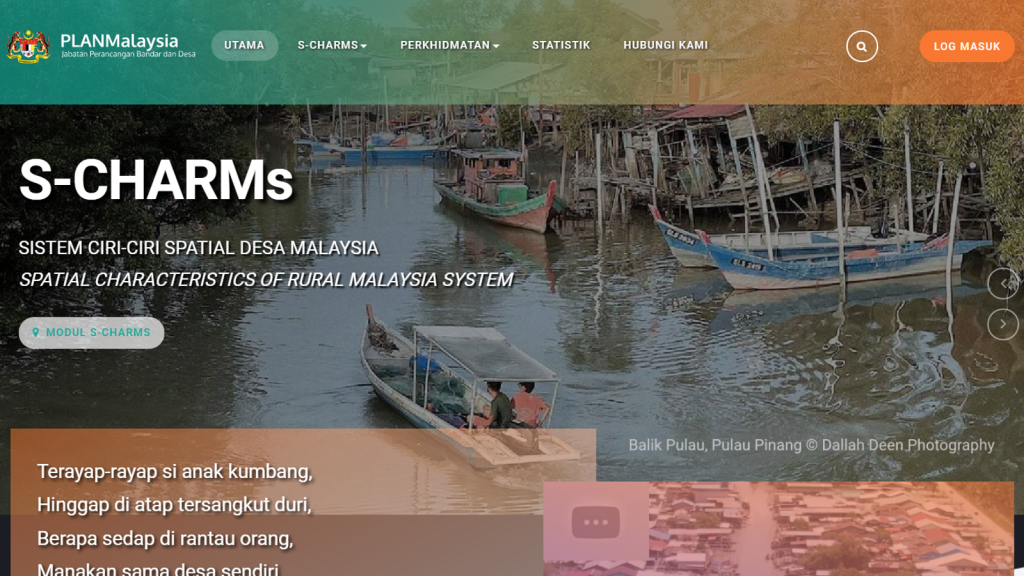
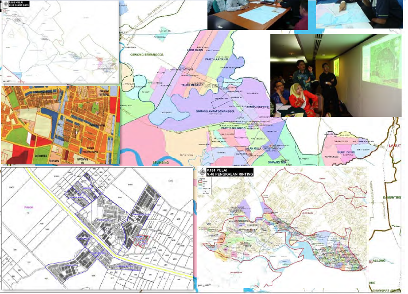
Development of Spatial Characteristic of Rural Malaysia System (S-CHARMS) for PLANMalaysia
S-CHARMS is an online web-GIS system to display information about rural in Peninsular Malaysia and WP Labuan and also analysis about public facilities and sustainability of rural Malaysia. The system include monitoring of Dasar Perancangan Fizikal Desa Negara 2030 implementation.
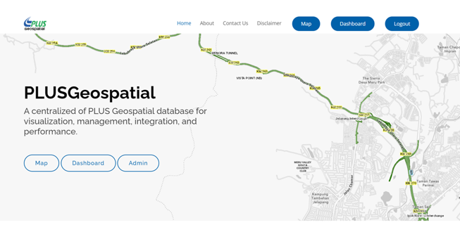
To Design, Develop, Test, Commission and Deploy the Reengineering of PLUS Geospatial Application for PLUS Berhad
A centralized of PLUS Geospatial database for visualization, management, integration, and performance. Some modules include routing, analysis module with 3D view, dynamic asset mapping (pavement condition), building information model, 3D model using LiDAR data.
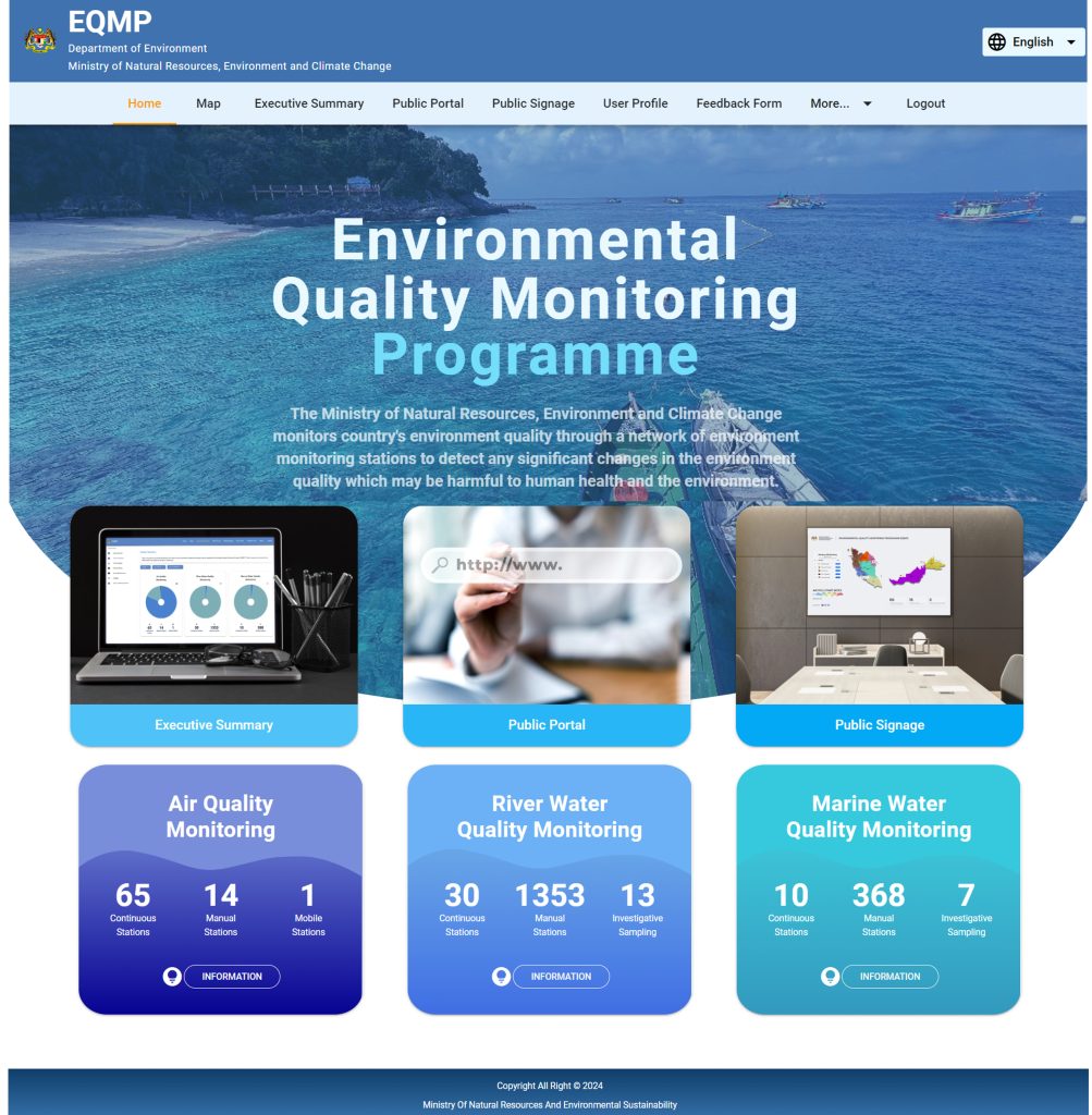
EQMP application system is a fully integrated Environmental Quality Monitoring Application Software and Portal. The systems includes:
Data transmission module from monitoring stations (for continuous and mobile stations) and laboratories (for manual sampling results
Automatic Data Validation and Quality Check (QA/QC) on collected raw data.
Online mapping of current and historical Air, River Water and Marine Water Quality data, including periodic reporting, ad-hoc reporting and exceedance reporting, complete with tables and graphs can can be generated in various format such as pdf, excel and csv.
Alert module to trigger data transmission and data exceedance alerts through email and SMS to designated personnel.
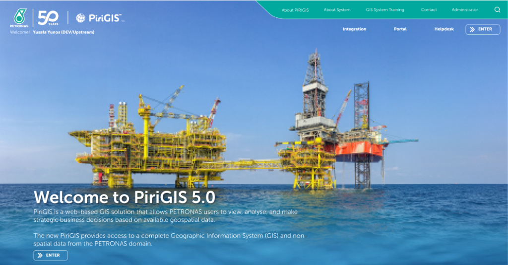
PETRONAS Geospatial Data and Geographical Information System (GIS) Services
PETRONAS Geospatial Data and Geographical Information System (GIS) services are key components of the company’s efforts to optimize its operations by integrating spatial data with analytical tools. PETRONAS Integrated Risk Management and Integrated Governance Information System (PIRIGIS) is a system developed to manage and monitor various aspects of risk, compliance, and governance across its operations. The system integrates multiple data sources to provide real-time insights into the risks that PETRONAS might face, enabling the company to take proactive measures to mitigate those risks.
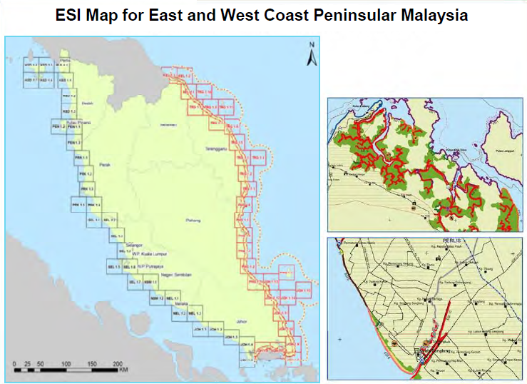
Environmental Sensitivity Index (ESI) Mapping Exercise for East and West Coast Peninsular Malaysia
An oil spill response map to reduce the environmental consequences of both spills and cleanup efforts, locating and prioritizing the most sensitive sites, and to reinforce the response capabilities for these areas and resolve the issue of competing priorities in the events of limited protection and clean-up resources during an incident.
Client: Petroliam Nasional Berhad
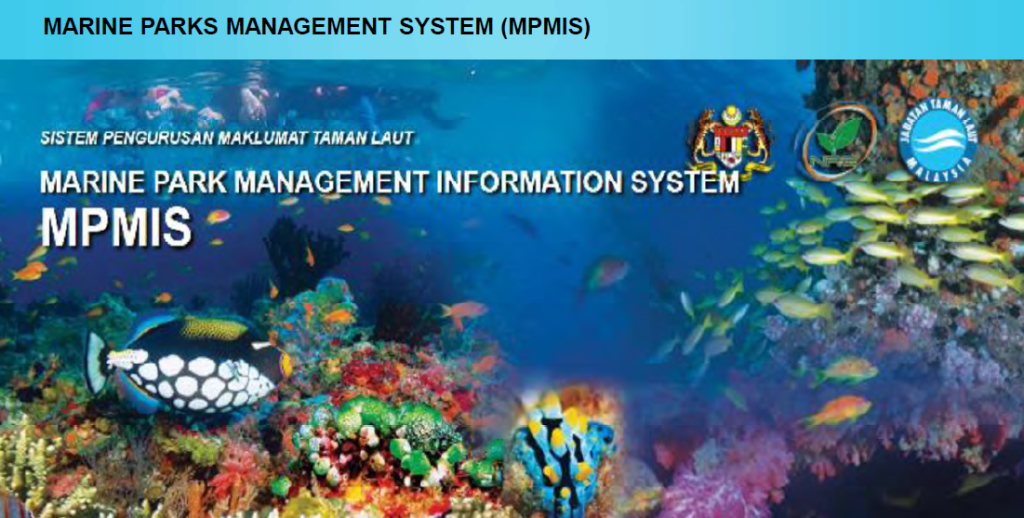
Marine Park Management and Inclusive Sustainable Island Development
Marine Park Management Information System or MPMIS, is a web based information management system, compete with web GIS viewer and certain management support applications to serve as a centralized Marine Park database management center. MPMIS is designed as a web based information management system complete with the following components:
Document management system to serve an online document repository.
Web based GIS data management and viewing system complete with GIS and satellite imageries for the 3 project sites.
Indicator monitoring component for marine resource management, enforcement, tourism, and socio-economic sectors.
User access control based on state, level and scope of responsibilities.
User registration and biometric information. System administration module.
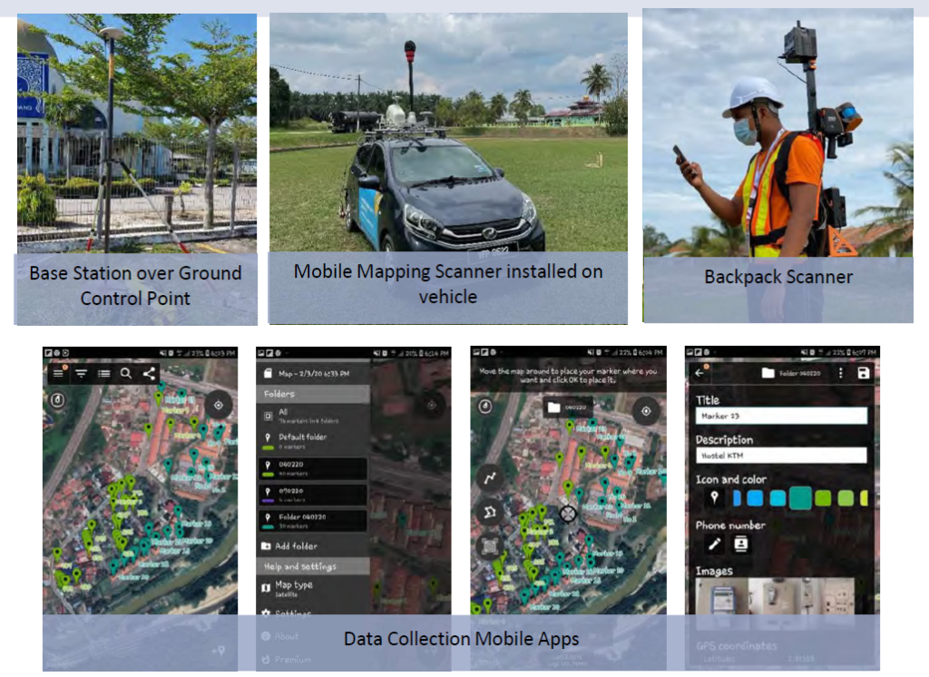
GIS Data Production of TNB LV Assets and Network - Mainhead C (Bangi West)
To complete GIS data production of LV assets and network including customer meter using mobile mapping technology. Collected data from mobile mapping and backpack that need to be delivered to TNB GIS shall consists of 360-degree equirectangular image, LiDAR data, and GIS data (consisting of LV assets, LV network and LV customers). The LV data production area shall cover all on-roads, off roads and inaccessible area/premises to TNB customers.
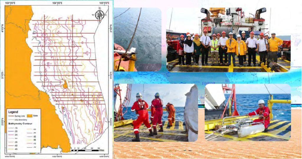
Marine Geophysical Survey Services on Data Acquisition, Processing & Interpretation of Pahang & East Coast Johor Offshore
This project using GIS to analyze and compile all required data and information to produce map of potential sand resources area. The survey area of approximately 38,000km2 covers from Chukai in the north and extending down to Mersing for 2017 and Tanjung Sekakap, boundary of Pahang and extending down to Desaru. 40 survey lines planed perpendicular and 6 survey lines planned parallel to shoreline. Analogue systems mainly consisted of Single Beam Echo Sounder (SBES), Sub-bottom Profiler System (Boomer & Pinger) and Side Scan Sonar system (SSS). The output are sand coverage, approximate thickness of sand deposit and potential sand area.
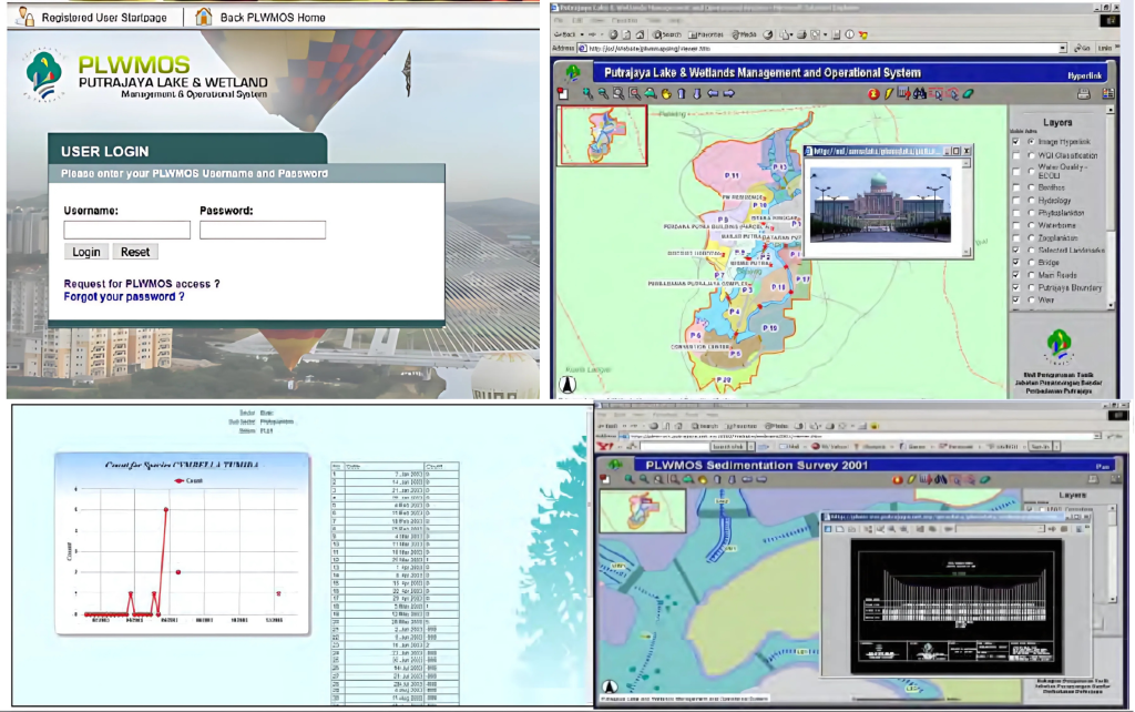
Putrajaya Lake & Wetlands Management and Operational System (PLWMOS)
PLWMOS is an internet-based Management Support System application to integrate, coordinate, and facilitate monitoring, management, and planning of Putrajaya Lake & Wetlands. This system serves as the main environmental database and spatial analytical tool for the survey of hydrology, physio-chemical, and biotics parameters of Putrajaya lake and wetlands. The PLWMOS has functionalities for data entry, environmental modeling and online report submission and linked to the existing system/s within CMS.